
One-hundred-and-fifty years ago today, on September 7, 1869 a 31-year-old John Muir made the first recorded ascent of Yosemite's Cathedral Peak. In this posting I present Muir's description of his climb and his subsequent journey that day from his book My First Summer in the Sierra. To illustrate Muir's words I've selected photographs I've taken over the last 44 years.
Muir wrote that he would never forget this "big, divine day" and 150 years later people he fought to save wild places for can remember his big day too. I thank John for saving Yosemite so I could revel in its wild wonders all my adult life.
[Note: Click on an image to enlarge.]
Below are two panoramas I made from Johnson Peak which show the seven steps of Muir's September 7, 1869 grand adventure (click pans to read notations).


Muir wrote: "September 7. Left camp at daybreak and made direct for Cathedral Peak, intending to strike eastward and southward from that point among the peaks and ridges at the heads of the Tuolumne, Merced, and San Joaquin rivers."
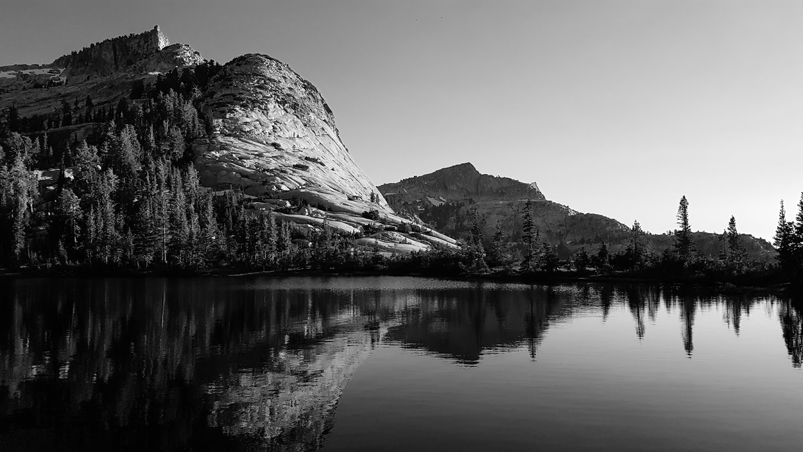
"Down through the pine woods I made my way, across the Tuolumne River and meadows . . ."

". . . and up the heavily timbered slope forming the south boundary
of the upper Tuolumne basin . . ."


". . . and up to its topmost spire, which I reached at noon . . ."


"The view from the Cathedral Spires is very fine and telling
in every direction. Innumerable peaks, ridges, domes, meadows, lakes, and
woods; the forests extending in long curving lines and broad fields wherever
the glaciers have left soil for them to grow on, while the sides of the highest
mountains show a straggling dwarf growth clinging to rifts in the rocks
apparently independent of soil."

"The dark heath-like growth on the Cathedral
roof I found to be dwarf snow-pressed albicaulis pine, about three or four feet
high, but very old looking."

"The body of the Cathedral is nearly square, and the roof slopes are wonderfully regular and symmetrical, the ridge trending northeast and southwest. This direction has apparently been determined by structure joints in the granite."

"The gable on the northeast end is magnificent
in size and simplicity, and at its base there is a big snow-bank protected by
the shadow of the building."

"The front is adorned with many pinnacles and a tall
spire of curious workmanship. Here too the joints in the rock are seen to have
played an important part in determining their forms and size and general
arrangement."

"The Cathedral is said to be about eleven thousand feet above the
sea, but the height of the building itself above the level of the ridge it
stands on is about fifteen hundred feet."

"A mile or so to the westward there is
a handsome lake, and the glacier-polished granite about it is shining so
brightly it is not easy in some places to trace the line between the rock and
water, both shining alike. Of this lake with its silvery basin and bits of
meadow and groves I have a fine view from the spires . . ."


". . . also of Lake Tenaya, Cloud's Rest, and the South Dome of Yosemite, Mt. Starr King, Mt. Hoffman, the Merced peaks, and the vast multitude of snowy fountain peaks extending far north and south along the axis of the range."


". . . also of Lake Tenaya, Cloud's Rest, and the South Dome of Yosemite, Mt. Starr King, Mt. Hoffman, the Merced peaks, and the vast multitude of snowy fountain peaks extending far north and south along the axis of the range."
[Note: Muir was mistaken about being able to see Lake Tenaya from the summit of Cathedral Peak. As you can see in this 1975 photo (below) I took from the summit, Tenaya Lake is blocked by the ridge (which I call "Bob's Point") south of Lower Cathedral Lake. Muir wrote his book about four decades after he climbed the peak so his memory failed him in this detail.]


Muir continues his narrative: "No feature, however, of all the
noble landscape as seen from here seems more wonderful than the Cathedral
itself, a temple displaying Nature's best masonry and sermons in stones. How
often I have gazed at it from the tops of hills and ridges, and through
openings in the forests on my many short excursions, devoutly wondering,
admiring, longing! This I may say is the first time I have been at church in
California, led here at last, every door graciously opened for the poor lonely
worshiper. In our best times everything turns into religion, all the world
seems a church and the mountains altars."

"And lo, here at last in front of the Cathedral is blessed cassiope, ringing her thousands of sweet-toned bells, the sweetest church music I ever enjoyed."


Here is Muir's sketch of Cathedral Peak which appears in his 1911 "My First Summer in the Sierra" book. I think Muir made this sketch just after his descent from the peak.

"And lo, here at last in front of the Cathedral is blessed cassiope, ringing her thousands of sweet-toned bells, the sweetest church music I ever enjoyed."

"Listening, admiring, until late in the afternoon I compelled myself to hasten away eastward back of rough, sharp, spiry, splintery peaks, all of them granite like the Cathedral, sparkling with crystals, --feldspar, quartz, hornblende, mica, tourmaline."

Here is Muir's sketch of Cathedral Peak which appears in his 1911 "My First Summer in the Sierra" book. I think Muir made this sketch just after his descent from the peak.

Below is my August 27, 2019 rephotograph of Muir's sketch (cropped to match the sketch). Muir made this sketch from a location just below Wilt's Col in the Echo Peaks.

Here is my uncropped photo for context.

This is Muir's likely approach up the north side of Echo Peaks near where he sketched Cathedral Peak.

Muir likely crossed over to the Merced River watershed just east of Echo Peaks 8 and 9 (seen on right of photo below).

[Note: Below is my rephotograph of Chiura Obata's 1930 woodblock print "Lake Basin in the High Sierra." This unnamed lake (which I call "Lake Obata") is located on the axis of the Cathedral Range southeast of Elizabeth Lake. In 1930 this steep north-facing ridge harbored a persistent snowfield which I think is Muir's "immense snow and ice cliff" that he nearly killed himself on after descending Cathedral Peak. This location for his misadventure is supported by his drawing of Cathedral Peak made from near Wilt's Col in the Echo Peaks and his likely camp at a tarn that lies on the east flank of Johnson Peak, which is less than a mile northeast of this ridge. Muir's intent to "strike eastward and southward" from Cathedral Peak was likely effected by first heading south up to Wilt's Col in Echo Peaks (as evidenced by his 1869 sketch made from there), then crossing over the north apron of Matthes Crest, ducking south of the Cockscomb to cross the dangerous snowfield above "Obata Lake" and then making camp at the tarn on the flanks of Johnson Peak.]

The panorama below shows the territory Muir likely traversed from Cathedral Peak (center), across Wilt's Col between Echo Peaks and Echo Crest (left of Cathdral Peak), then across the north apron of Matthes Crest (far left), to head east below the Cockcomb (far right).

This gap in the wall that runs south of the Cockscomb might have given Muir eastward passage towards the steep east-west-oriented ridge where he nearly killed himself on the north-facing shadowed snowfield that existed in his time (the steep section is hidden behind the pyramidal ridge at center).

Now we have followed Muir to his campfire and the shallow pool which gave the mountaineer poet and mystic a window into the universe. Muir writes:
"Camped beside a little pool and a group of crinkled dwarf
pines; and as I sit by the fire trying to write notes the shallow pool seems
fathomless with the infinite starry heavens in it, while the onlooking rocks
and trees, tiny shrubs and daisies and sedges, brought forward in the
fire-glow, seem full of thought as if about to speak aloud and tell all their
wild stories. A marvelously impressive meeting in which every one has something
worth while to tell. And beyond the fire-beams out in the solemn darkness, how
impressive is the music of a choir of rills singing their way down from the
snow to the river! And when we call to mind that thousands of these rejoicing
rills are assembled in each one of the main streams, we wonder the less that
our Sierra rivers are songful all the way to the sea."

Some people question whether Muir made it to the "topmost spire" of Cathedral Peak. I take him at his word. I also know he was a much better and riskier climber than me and I made it to the summit in 1975 with little climbing experience, no ropes on the way up, and a measure of youthful fearlessness.
The non-technical "mountaineer's" route to the topmost spire that Muir must have taken is up ledges on the west flank of the peak to the summit block. As this 1900 diagram in the Sierra Club Bulletin (Volume 3, page 239) shows, attaining the summit requires a sobering counter-clockwise movement from the southwest face of the block across a rounded exposed ledge to its southeast-face. Then using hands, feet, and knees you climb the 15-foot Class 4 chimney crack to the top.

This photo from the web shows that the final ascent is not difficult but dangerous due to the exposure of falling hundreds of feet. Muir would have had no problem with this.

 |
| My 1975 photo taken from the summit looking towards Budd Lake |
As you can see from my 1975 photo below there is only room for three or four at the top (yes, that me with the glasses and long-hair). I suspect that many more people have climbed Cathedral Peak in the 44 years since my 1975 ascent than had climbed it in the 106 years from Muir's ascent to mine!


