Monday, August 11, 2014
Climbing Yosemite's Central Mountain
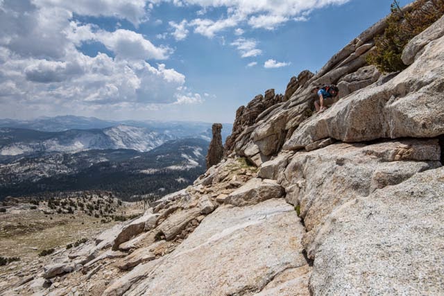
Yosemite's 10,850' Mount Hoffman is claimed to be the park's premier viewpoint as it lies right in the middle of the park and is surrounded on the north, east and south by the park's highest peaks. Many notable features are laid out before you such as Cloud's Rest, Half dome, Mount Clark, Cathedral Peak, Tenaya Lake, Tuolumne Meadows, Mount Dana, Mount Conness, the Matterhorn and Tower Peak. A few years ago I climbed just shy of the summit with my niece Lauryn and friend Arnie.
Staying the night before at May Lake I finally summited the mountain on a solo climb in early August 2014. It's a 1500' walk-up ascent on a "ducked" or cairn-posted unmaintained trail to the base of the summit block. Then its a few hundred feet of scrambling on sloping slabs to the top which has a park radio repeater antenna crowning its summit. Two forest fires were visible from the summit, including the 'Dark Hole" Fire, which I include two photos of. Enjoy this photographic climb and return to May Lake. By the way, May was the wife of the 19th Century geologist Charles Hoffman for whom the peak is named.
P.S.: If you left click on the first image you get a filmstrip you can click to view the next or any slide you want.
Finding John Muir's Glacial Meadow
In his "My First Summer in the Sierra" an elderly Muir published his memoirs and edited journal entries from his 1869 four month saunter as a 33 year-old shepherd tending his "hooved locusts" across the northern reaches of what would become Yosemite National Park. In no small part the rich experiences Muir had on this youthful and exuberant round trip across the "Range of Light" created the Muir we know as well as the park and park system he helped create.
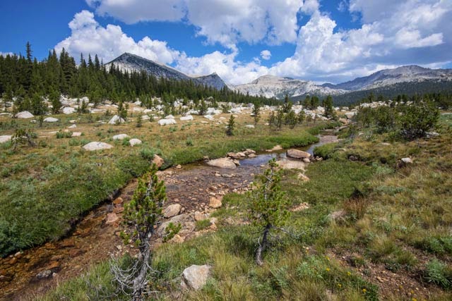
Since reading this book as a 19 year-old Army private on my first visit to Yosemite in 1968 I have been curious where his "glacier meadow camp north of Soda Springs" was. It was generally believed to be the unofficially-named "Delaney Meadow" on Delaney Creek named after the man who owned the sheep Muir was in charge of. But I saw on the map a much larger meadow that better fitted the dimensions Muir gave: 1.5 miles long by a quarter mile wide.
So I set off from Tuolumne Meadows in early August 2014 to ground-truth both meadows and see what they could tell me. After struggling through a tangle of downed lodgepole pines for the half mile between the two meadows I emerged at the larger one. I soon saw that Mt Dana cannot be seen from here and Muir clearly describes seeing the moon rise over Dana from his camp. So Muir's camp is indeed the lower meadow where Dana is seen. I did, however, discover for myself what Muir had surely found out, that the upper meadow is incredibly beautiful and worth every effort to get there. Enjoy these images of my meadow meanderings!
P.S.: If you left click on the first image you get a filmstrip you can click to view the next or any slide you want.
Following John Muir into Yosemite's Ten Lakes Basin
In September of 1871 a 33 year-old John Muir climbed out of his Yosemite Valley looking for evidence of past glaciers. In his mountain rambles he discovered for himself the Grand Canyon of the Tuolumne River. In August of 2014, 143 years after Muir, I followed his route up the upper Yosemite Creek to its headwaters near Ten Lakes Pass. I discovered for myself the two viewpoints the young Muir climbed out to in order to see 4,000 feet down into the Tuolumne Canyon. I heard what he heard-- the singing river far below and I saw many of the flowers, animals and geological features that he described and sketched in his journal and reworked in later articles and books.
In my three-day solo backpack I visited eight of the nine lakes in the basin and saw many beautiful images--the best of which I include here. Enjoy the blessings of this gentle wilderness.
P.S.: If you left click on the first image you get a filmstrip you can click to view the next or any slide you want.
Subscribe to:
Comments (Atom)


